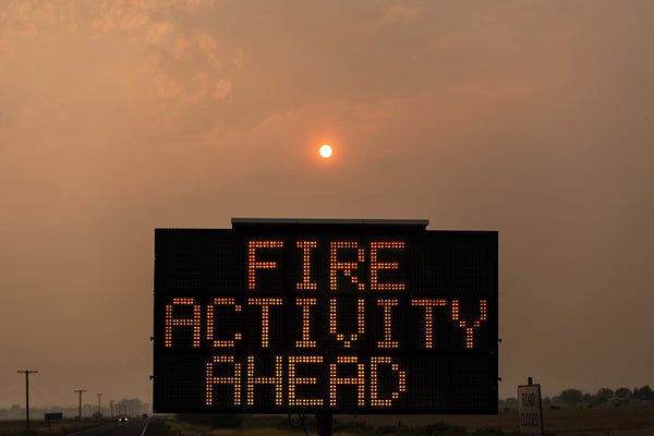
CLIMATEWIRE | Wildfires threaten nearly one-third of U.S. residents and buildings, according to a new government analysis that suggests the risk is greater than previously known.
CLIMATEWIRE | 根据一项新的政府分析,野火威胁着近三分之一的美国居民和建筑,该分析表明野火的风险比之前已知的更大。
The Forest Service, working with Montana researchers, took a new approach to measuring wildfire risk and limited its historical analysis to the 15 years between 2004 and 2018. A previous analysis considered conditions over 34 years ending in 2012.
林务局与蒙大拿州的研究人员合作,采用了一种新的方法来衡量野火风险,并将其历史分析限制在 2004 年至 2018 年的 15 年间。之前的分析考虑了截至 2012 年的 34 年间的情况。
The narrower and more recent time frame aims to focus on a period during which climate change has notably affected atmospheric conditions and led to intensifying heat, drought and wildfire.
时间范围较窄,时间较近,旨在关注气候变化对大气条件产生显著影响并导致高温、干旱和野火加剧的时期。
“We’re more accurately reflecting climate changes that we’ve seen in the last few years,” said Kelly Pohl, associate director at the nonprofit Headwaters Economics, which released the findings with the Forest Service and Pyrologix, a wildfire risk modeling firm.
"非营利组织 Headwaters Economics 的副主任 Kelly Pohl 说:"我们更准确地反映了过去几年的气候变化。
The Forest Service published its new assessment Wednesday as an update to its risk estimates from 2020. Wildfirerisk.org identifies the most fire-prone parts of the county and helps guide wildfire mitigation efforts.
林业局周三公布了新的评估结果,作为对 2020 年风险估计的更新。Wildfirerisk.org网站确定了该县最易发生火灾的地区,并帮助指导野火减灾工作。
The updated analysis says more than 115 million people and 48 million buildings are located in counties facing high wildfire risk. Underserved communities are disproportionately exposed.
更新后的分析报告称,有超过 1.15 亿人和 4800 万栋建筑位于面临野火高风险的县。未得到充分服务的社区面临的风险更大。
Nearly 75 percent of tribal area residents are in counties with high wildfire risk. And nearly 20 percent of high-risk counties have a large share of mobile homes, the analysis found.
近 75% 的部落地区居民居住在野火高风险县。分析发现,近 20% 的高风险县拥有大量移动房屋。
“This update tells us the nation’s wildfire crisis has the potential to impact more people than we originally thought,” Jeff Marsolais, a Forest Service associate deputy chief, said in a statement.
"林务局副局长杰夫-马索莱斯(Jeff Marsolais)在一份声明中说:"这一最新情况告诉我们,全国野火危机对更多人的影响有可能超过我们最初的想象。
“That top-level finding is a big deal,” said Pohl. “We really need to be thinking about community-level solutions in lots of parts of the country.”
"Pohl 说:"这一最高级别的发现意义重大。"我们确实需要考虑在全国许多地方采取社区一级的解决方案。
The update comes as wildfire seasons grow longer, more destructive — and more expensive.
随着野火季节越来越长、破坏性越来越大、成本越来越高,该系统也随之更新。
A 2023 analysis by Congress’ joint Economic Committee broadly analyzed wildfire damage including the effect on real estate values, property, watersheds, timber, insurers and more. Wildfires cost the U.S. $394 billion to $893 billion a year, the committee concluded.
美国国会联合经济委员会 2023 年的一份分析报告广泛分析了野火造成的损失,包括对房地产价值、财产、流域、木材、保险公司等的影响。委员会的结论是,野火每年给美国造成 3940 亿至 8930 亿美元的损失。
Fueling the damage are overgrown forests, development in high-risk areas and rising temperatures, which exacerbate the hot, dry conditions that help wildfires catch and spread.
森林杂草丛生、高风险地区的开发以及气温升高加剧了炎热干燥的环境,而这些因素都助长了野火的蔓延。
States, insurance companies and modeling firms are trying to improve wildfire modeling and data to pinpoint where fires might ignite, spread and cause the most devastation.
各州、保险公司和建模公司都在努力改进野火建模和数据,以确定火灾可能在哪些地方点燃、蔓延并造成最大破坏。
The information can help decide how to spend billions of dollars that the federal government and some states have provided for mitigation. The bipartisan infrastructure law and the Inflation Reduction Act include about $4 billion combined for “hazardous fuels mitigation.”
这些信息有助于决定如何使用联邦政府和一些州提供的数十亿美元减灾资金。两党共同制定的基础设施法和《通货膨胀削减法》中,用于 "危险燃料减灾 "的资金合计约 40 亿美元。
The First Street Foundation, a New York nonprofit focused on physical climate risk data, has done its own advanced modeling. The research group unveiled its national fire risk assessment in 2022 that said 26 million U.S. properties faced moderate wildfire risk at the time — and the figure could jump to 35 million by 2052.
第一街基金会(First Street Foundation)是纽约一家专注于物理气候风险数据的非营利组织,该基金会已经完成了自己的高级建模工作。该研究机构于 2022 年发布了全国火灾风险评估报告,称当时美国有 2600 万处房产面临中度野火风险,而到 2052 年,这一数字可能会跃升至 3500 万处。
Colorado in 2023 overhauled its own outdated fire risk map to account for development in high-risk areas as well as a pine beetle epidemic that left behind 3 million acres of dead, flammable trees. Officials said the changes would help communities prepare for future blazes.
2023 年,科罗拉多州全面修订了自己过时的火灾风险地图,以考虑到高风险地区的发展情况以及松树甲虫疫情(该疫情造成 300 万英亩树木枯死、易燃)。官员们表示,这些变化将有助于社区为未来的大火做好准备。
The Forest Service made several changes to its wildfire risk tool in addition to narrowing its modeling to 15 years.
除了将建模范围缩小到 15 年之外,林业局还对其野火风险工具进行了几处修改。
The new version includes updated data about where homes and buildings are located and what types of trees, shrubs and grasses are present on various landscapes. The changes help capture the risk of “low-probability, high-impact events like those that we’ve recently seen in parts of the country, like the Pacific Northwest,” Pohl of Headwaters said. “And we’re better able to represent the way embers can spread wildfires into communities.”
新版本包括有关住宅和建筑物位置以及各种地貌上的树木、灌木和草的更新数据。这些变化有助于捕捉 "低概率、高影响事件 "的风险,比如我们最近在美国西北太平洋等地区看到的那些事件。"我们能够更好地体现余烬将野火蔓延到社区的方式"。
The newly released tool shows that more than 60 percent of the counties in both Oregon and Washington have high wildfire risk, up from 47 percent in the Forest Service's 2020 estimate.
新发布的工具显示,俄勒冈州和华盛顿州 60% 以上的郡都有较高的野火风险,高于林业局 2020 年估计的 47%。
Wildfirerisk.org now includes features to help communities better understand and respond to wildfire threat.
Wildfirerisk.org 现在包括帮助社区更好地了解和应对野火威胁的功能。
One example, which Pohl called a “vulnerable populations section," lets users identify neighborhoods that might struggle to prepare for or respond to wildfire because of demographics. The neighborhoods might have a large number of residents who don’t speak English or don’t have cars. Local officials could decide to translate disaster communications into various languages or adjust emergency evacuation plans.
其中一个例子被 Pohl 称为 "弱势群体部分",它可以让用户识别出那些由于人口结构原因而在准备或应对野火方面可能比较困难的社区。这些社区可能有大量不会说英语或没有汽车的居民。地方官员可以决定将灾难通讯翻译成各种语言或调整紧急疏散计划。
“These are really helpful resources at the federal level, to think about where risk is greatest across the country,” Pohl said. “But also within a community, to think about the different neighborhoods that might experience wildfire preparation and wildfire recovery differently.”
"Pohl 说:"这些都是联邦层面上非常有用的资源,可以帮助我们思考全国范围内哪些地方的风险最大。"但在一个社区内,考虑不同的社区可能会经历不同的野火准备和野火恢复。
Reprinted from E&E News with permission from POLITICO, LLC. Copyright 2024. E&E News provides essential news for energy and environment professionals.
经 POLITICO, LLC 许可,转载自 E&E News。版权 2024 年。E&E News 为能源和环境专业人士提供基本新闻。
